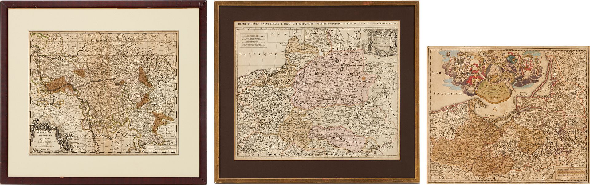
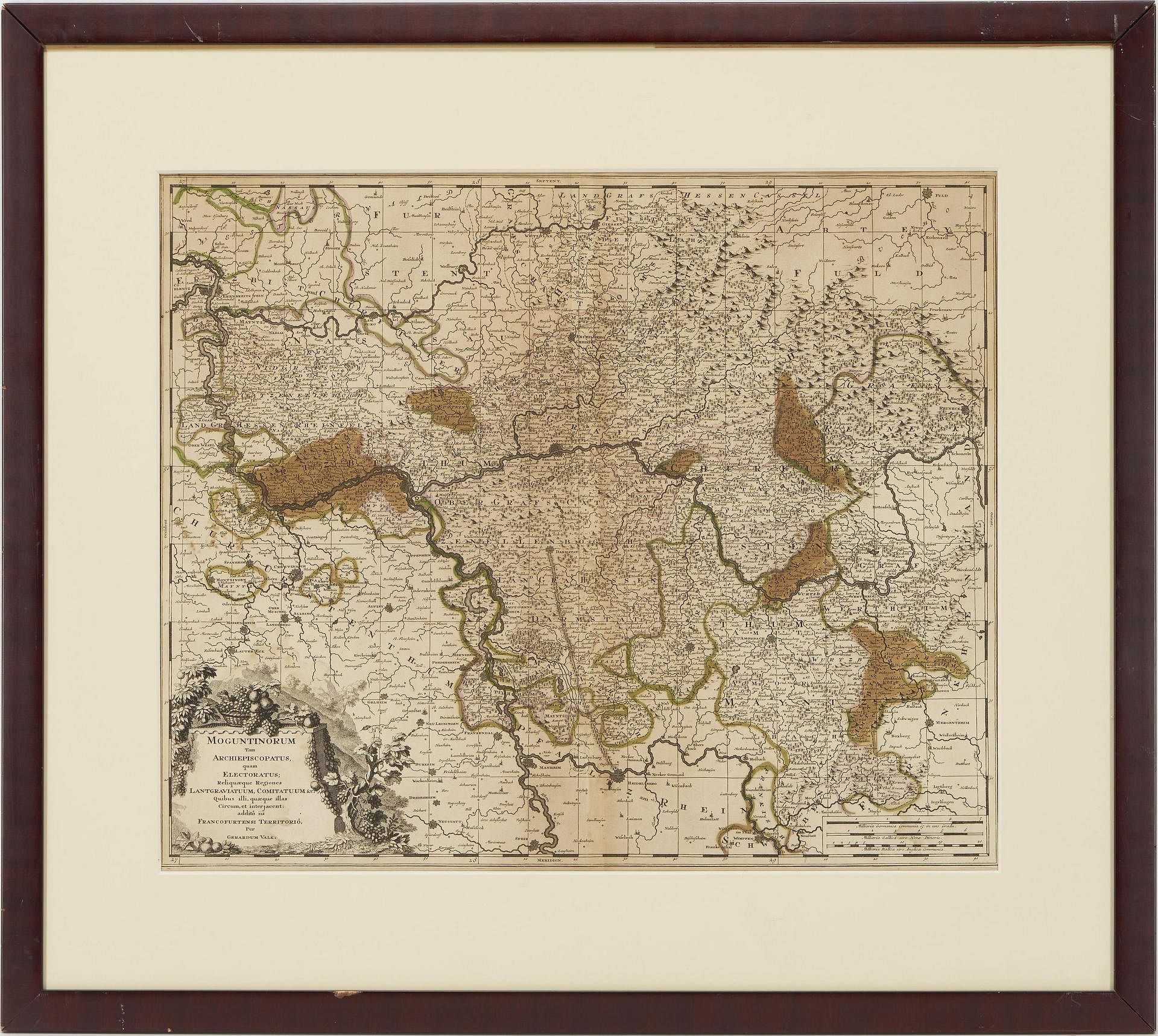
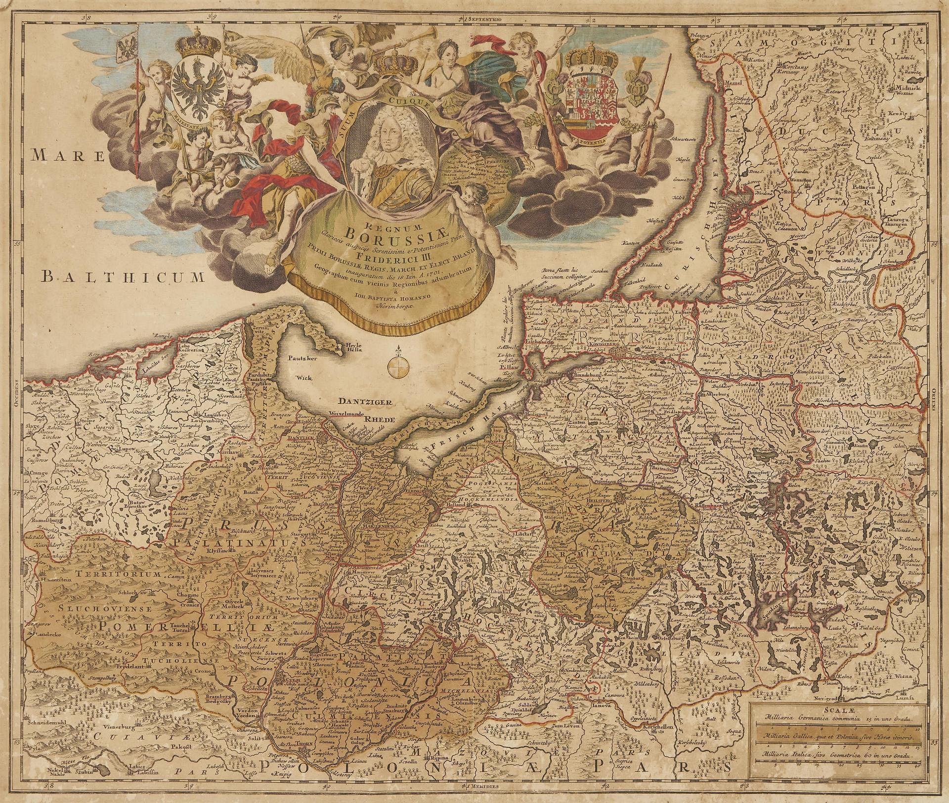
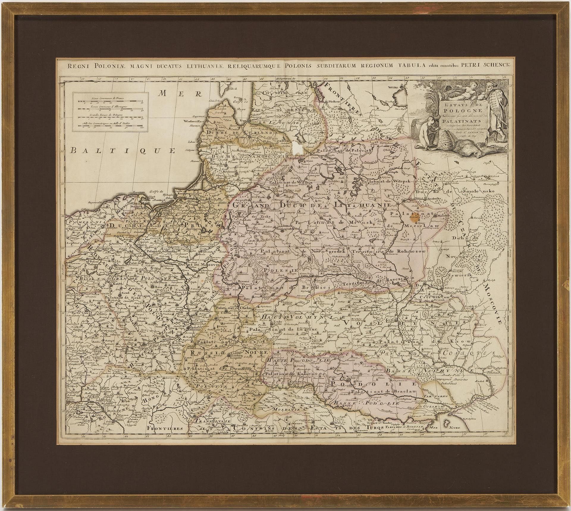
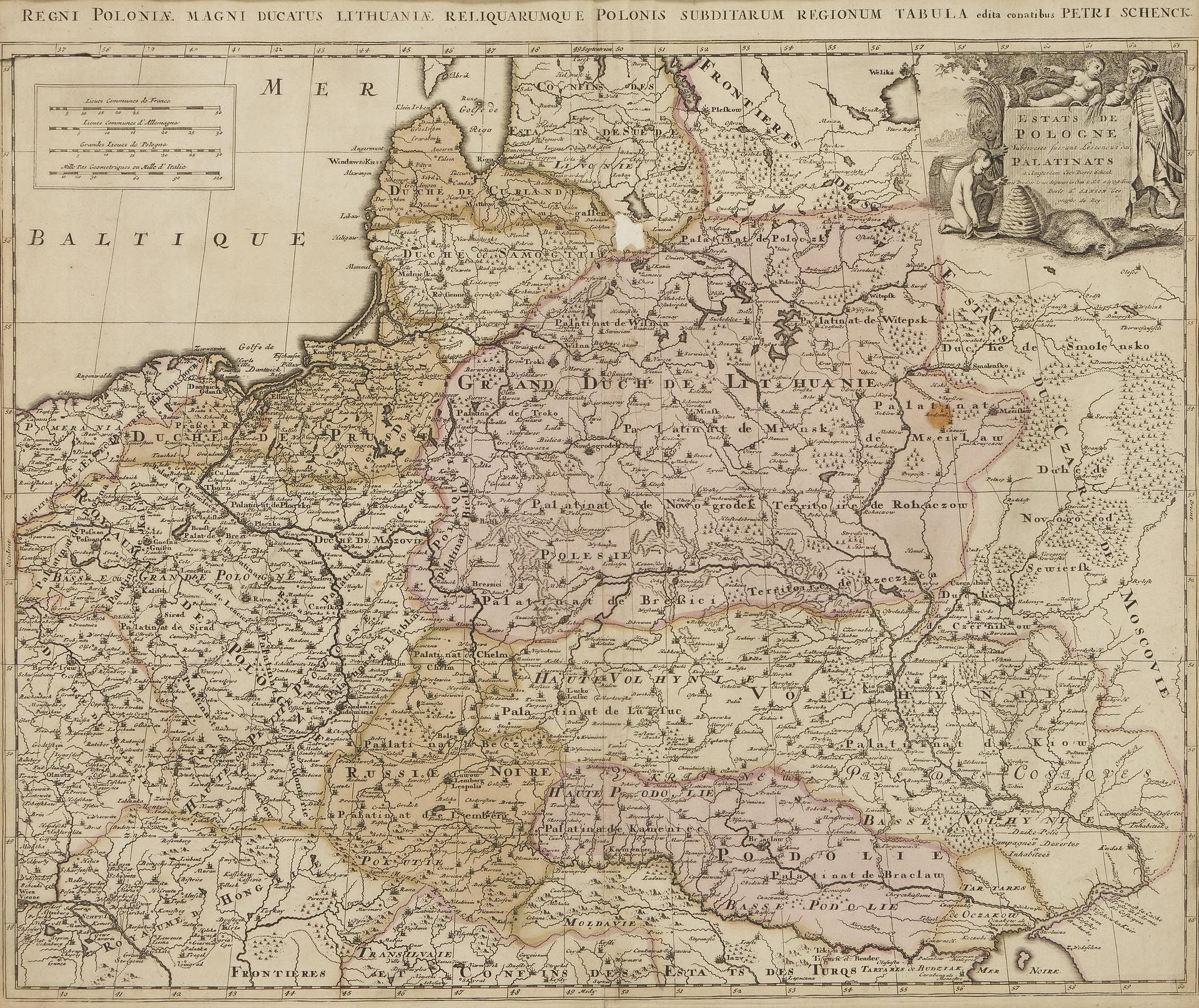
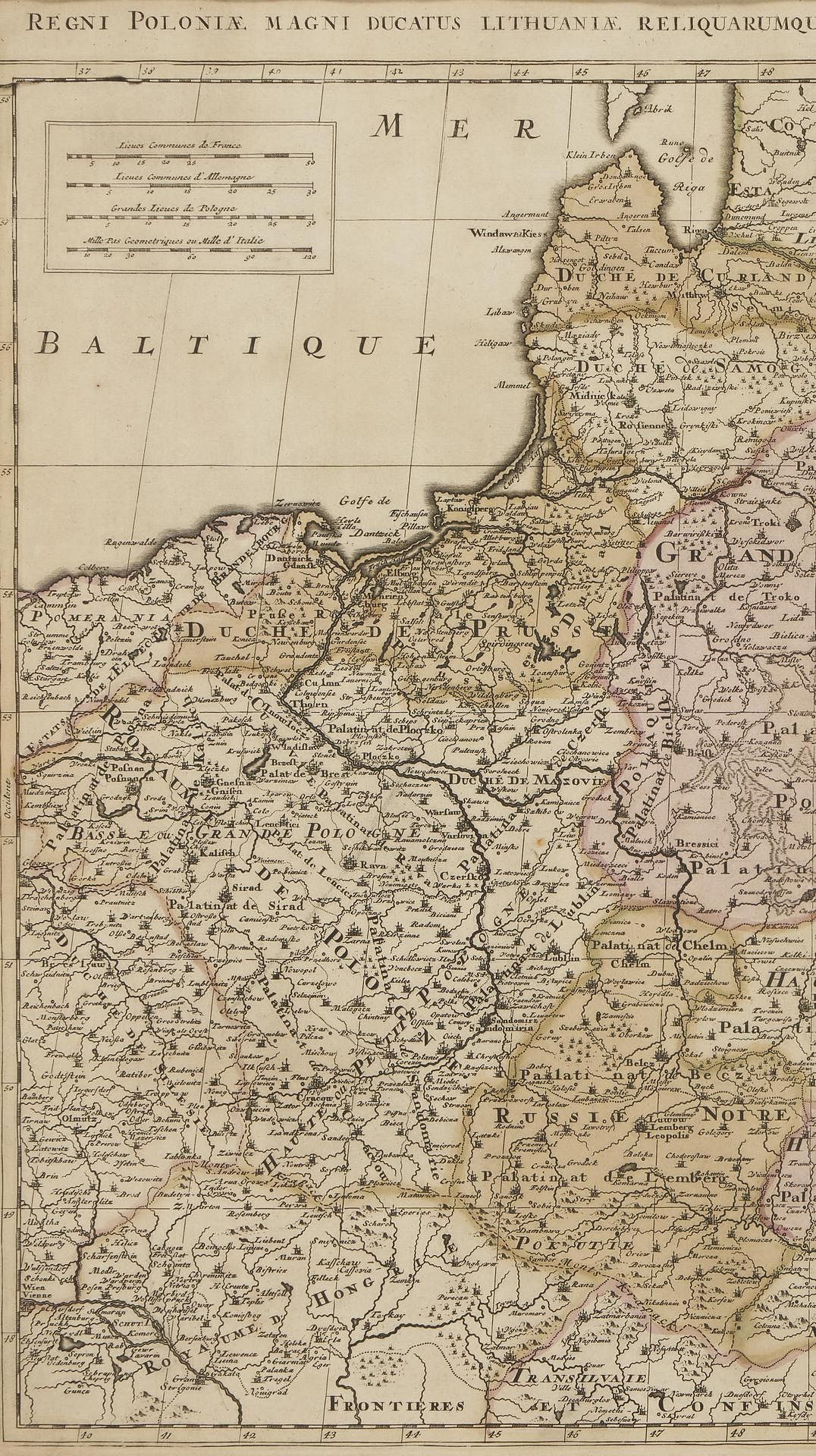
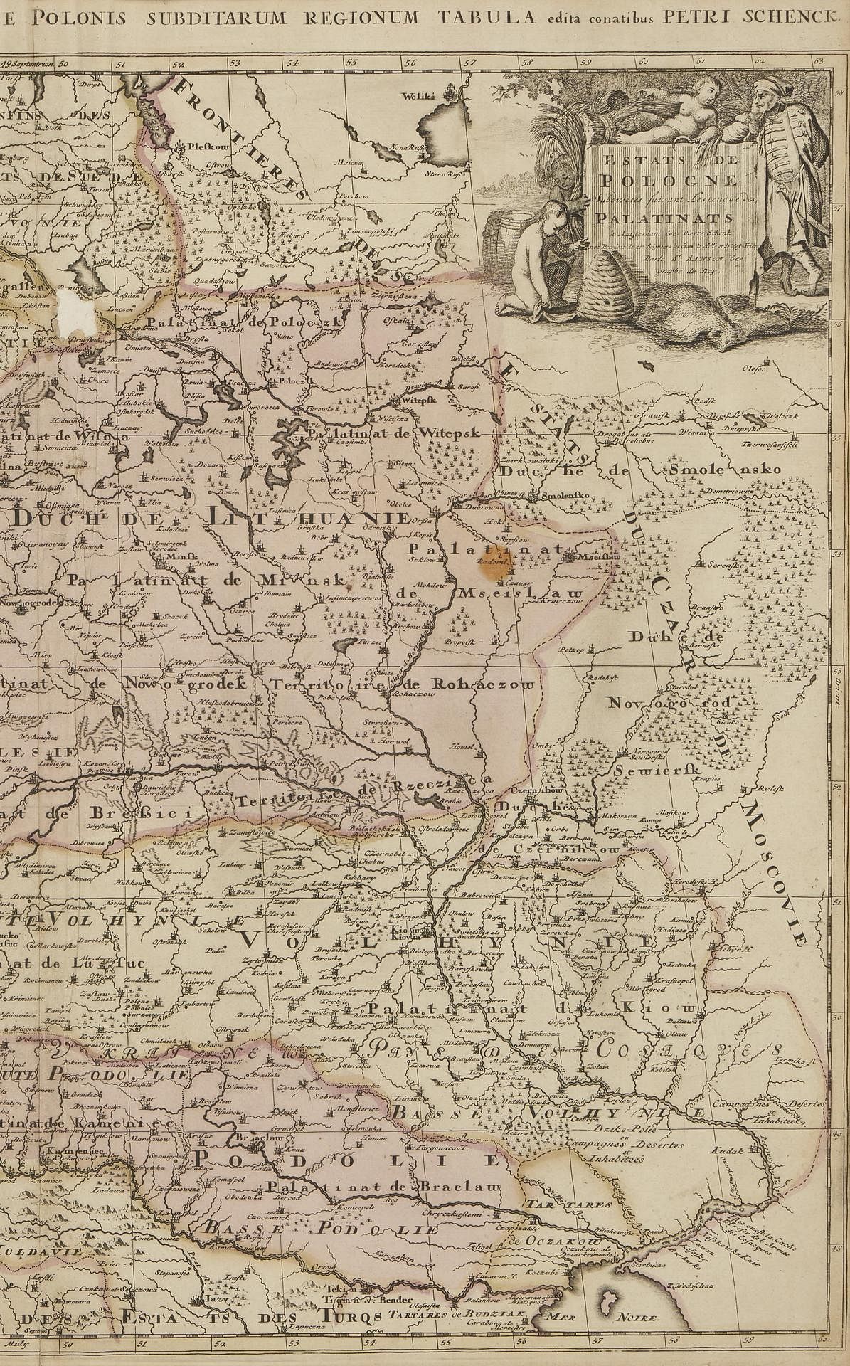
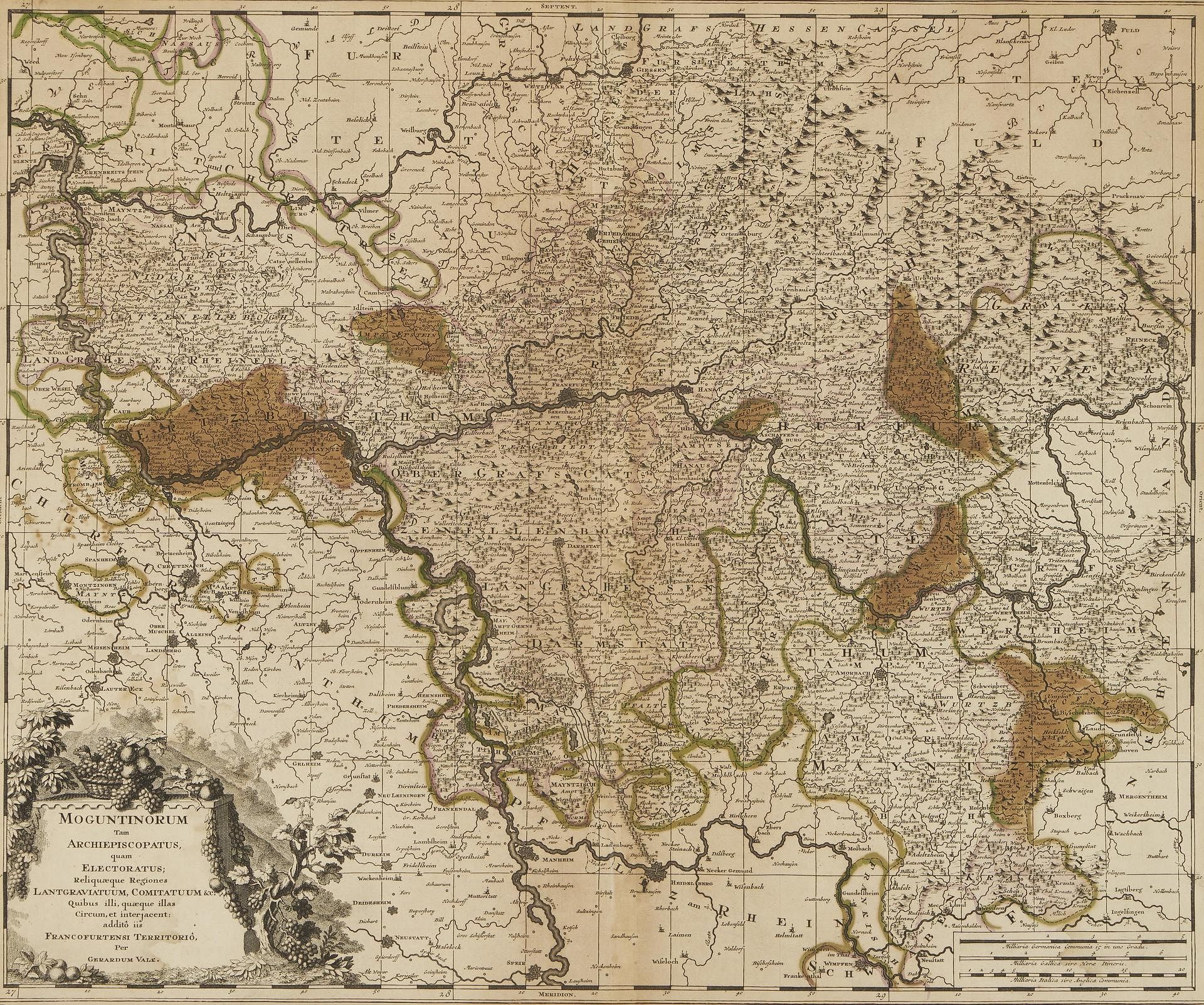
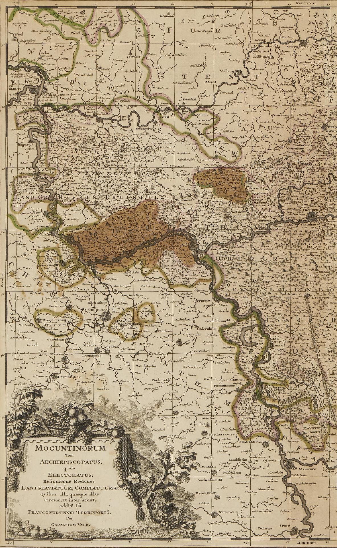
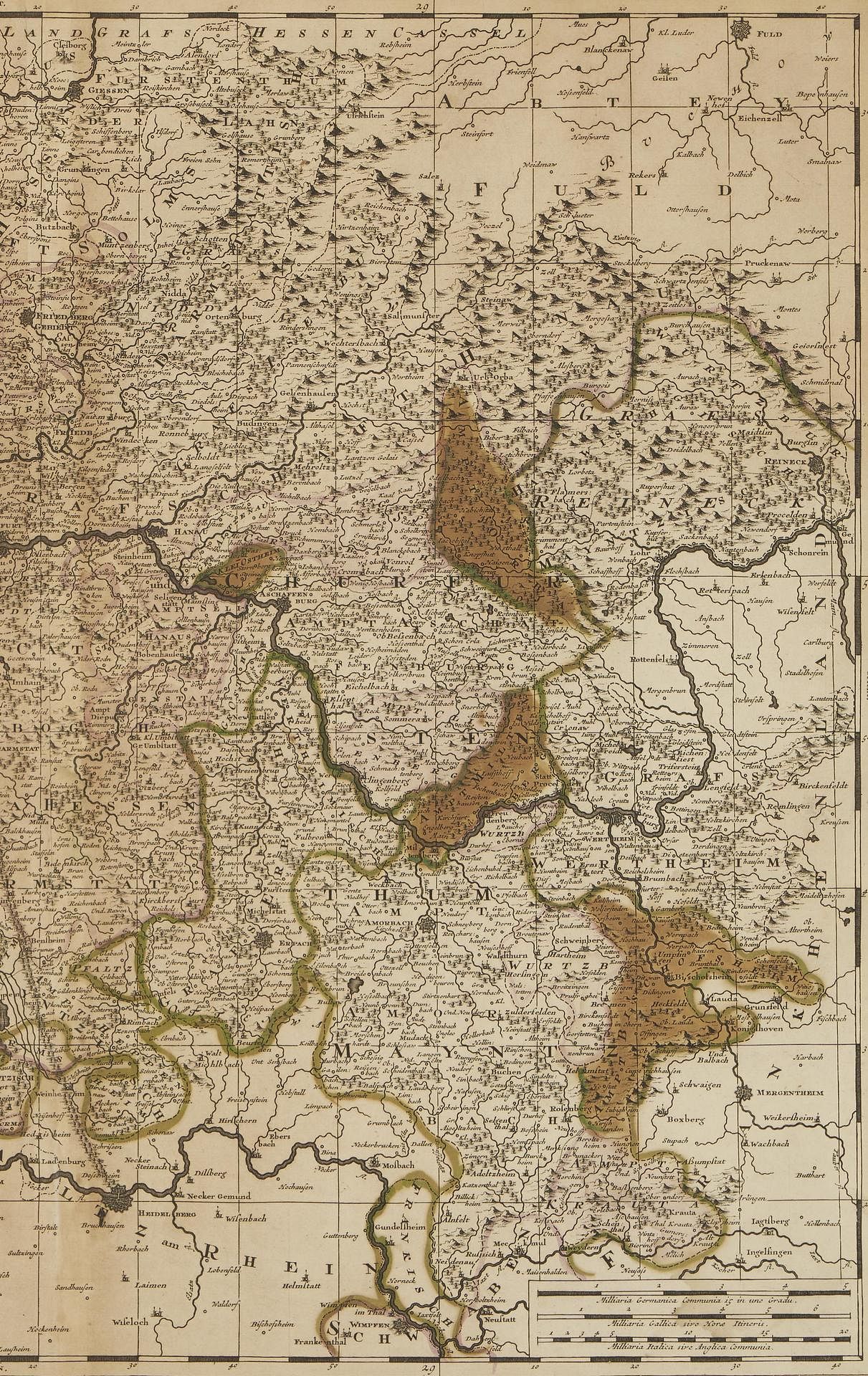
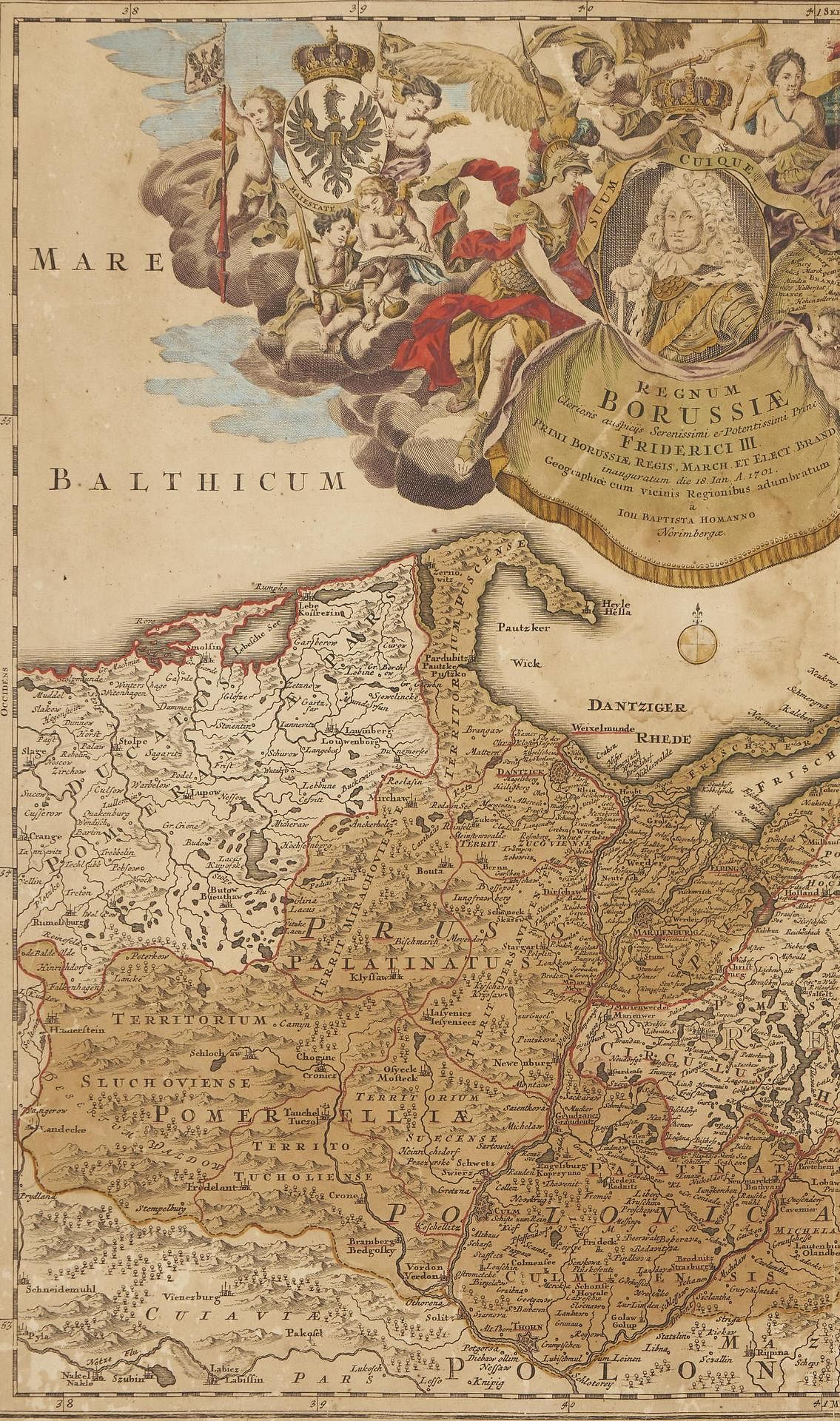
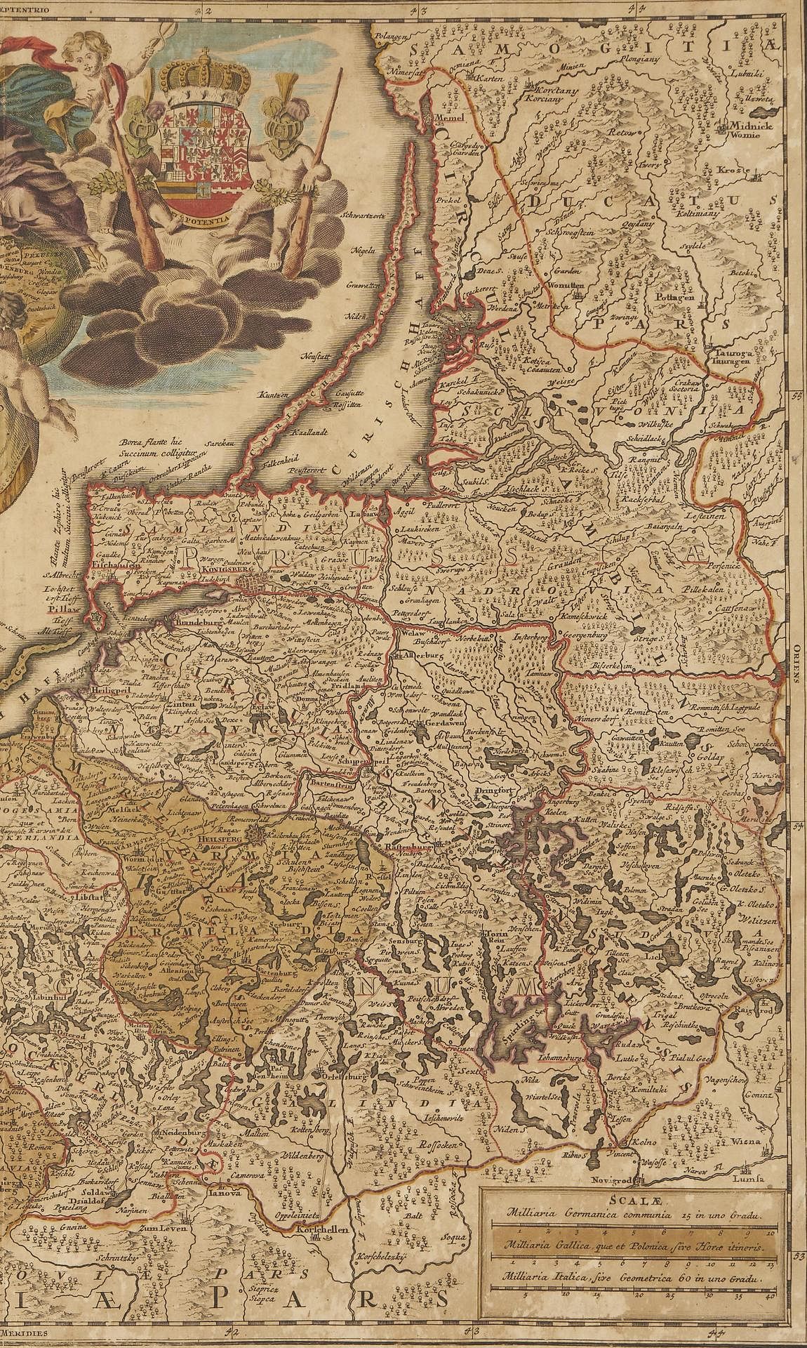
1st item: ESTATS DE POLOGNE SUBDIVISES SUIVANT LESTENDUE DES PALANTINATS map, published by Pieter Schenk, Amsterdam, ca. 1700. Copperplate engraving with hand-coloring depicting the States of Poland, including cities and towns, territory borders, bodies of water, mountain ranges, and other points of interest, with French and Latin text. Titled, across top above map; decorative title cartouche with human figures and agricultural crops, top right; scale of miles, top left. Surrounded by scale notations. Typed information label, en verso. Housed under glass and matted in a giltwood frame. Image: 18 1/8" H x 22 3/4" W. Sight: 19 1/4" H x 23" W. Framed: 25 1/4" H x 28 1/2" W. 2nd item: MOGUNTINORUM TAM ARCHIEPISCOPATUS QUAM ELECTORATUS RELIQUAEQUE REGIONES LANTGRAVIATUUM COMITATUUM &C map, published by Gerard Valk, Amsterdam, ca. 1700. Copperplate engraving with hand-coloring depicting the Electorate of Mainz state of the Holy Roman Empire, including cities and towns, territory borders, bodies of water, mountain ranges, and other points of interest, with German and Latin text. Decorative title cartouche with images of flora, lower left, scales of miles, lower right. Surrounded by scale notations. Typed information label, en verso. Matted and housed under glass in a wooden frame. Image: 19 3/8" H x 23" W. Sight: 19 3/4" H x 23 1/2" W. Framed: 29" H x 32 1/2" W. 3rd item: REGUM BORUSSIAE GLORIOSIS AUSPICIJS SERENISSIMI E POTENISSIMI PRINC FRIDERICI III map, engraved and published by Johann Baptist Homan in "Maior Atlas Scholasticus", Nuremberg, ca. 1710. Copperplate engraving with hand-coloring depicting East and West Prussia along the Baltic Coast, including cities, and towns, territory borders, bodies of water, mountain ranges, and other points of interest, with German and Latin text. Elaborate title cartouche depicting an interpretation of the Konigsberg assentation of Frederick III of Brandenburg, who crowned himself King of Prussia in 1701, top left and center, scale of miles, lower right. Typed information label, en verso. Adhered to piece of cardstock backing, unframed. Image: 19 3/8" H x 22 3/4" W. Sheet: 21" H x 24 1/4" W.
The Collection of Dr. Joe Newsom Rawlings, Davisboro, Georgia.
Condition
Not examined outside of frames. 1st item: Overall good condition with toning/acid burn, some dampstaining. 3/4" x 5/8" area of repair, top center of map. Possible 1" tear, lower center of fold line. 2nd item: Overall good condition with scattered foxing spots, toning/acid burn, some dampstaining. Not examined outside of frame. Frame with some abrasions. 3rd item: Overall toning/acid burn with areas of damp staining, largest 3 3/4" x 4", abrasions, creases. Tears/areas of loss, largest 2 1/2", to edges of sheet.